This article contains affiliate links. If you book through them, I earn a small commission at no extra cost to you.
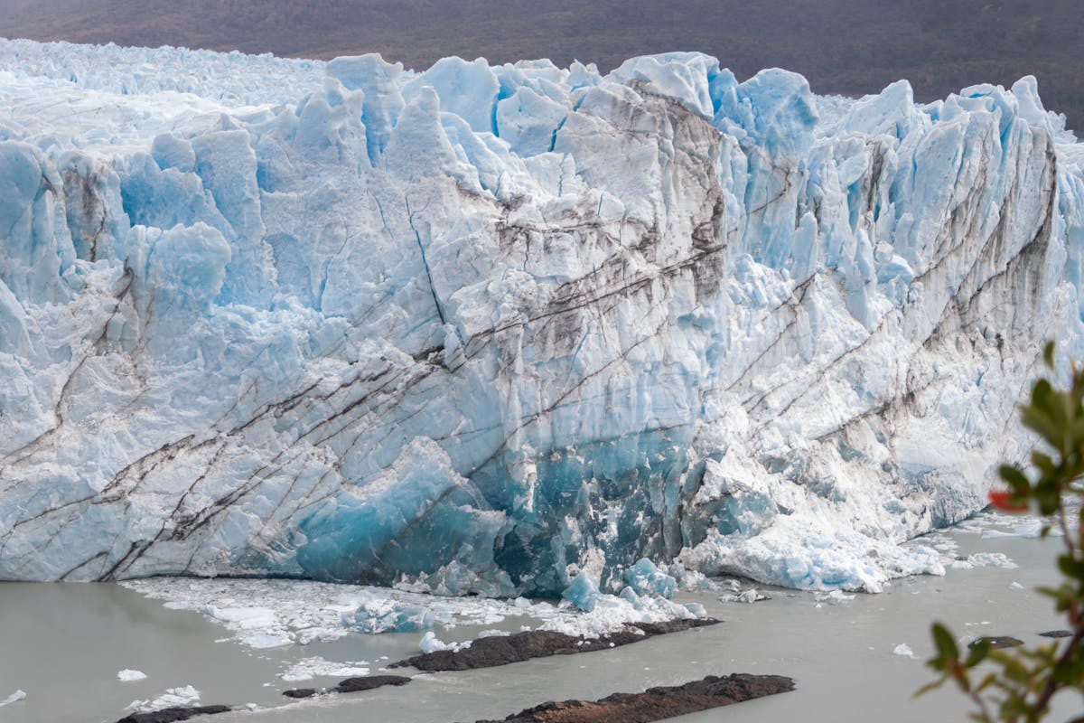
The ice cracked like a rifle shot and a piece of Perito Moreno the size of a delivery truck peeled off the face and fell into the lake below. The crowd gasped. A woman beside me dropped her mate. And I just stood there with my jaw open, trying to process what I was looking at — a wall of ice sixty meters tall, electric blue at its core, calving in real time while I ate a sandwich on a metal walkway in Argentina.
That was day nine of two weeks in Patagonia. I had already been wrecked by wind in Torres del Paine, sleep-deprived in Puerto Natales, border-crossed through Tierra del Fuego in a rainstorm, and had my pack searched twice by Argentine customs. And I still had El Chalten ahead of me. This trip was the hardest, coldest, most physically demanding thing I have done — and I would do every single day of it again.
Here is the two-week route that worked, the parts that almost didn't, and what I would change next time.
Why Combine Chile and Argentina (and Why Most People Don't)
Most Patagonia itineraries stick to one side. The Chile-only crowd does Torres del Paine and calls it done. The Argentina-only crowd does El Calafate and El Chalten. Both are valid trips. But they miss the full picture.
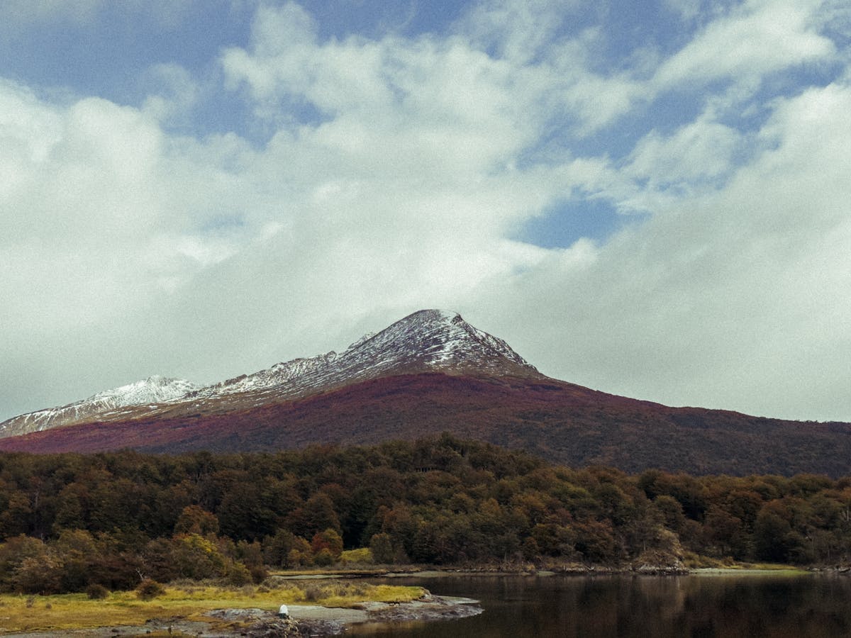
The two sides of Patagonia feel genuinely different. Chilean Patagonia is wilder, wetter, more remote — the infrastructure is thinner and the landscapes have a raw, unfinished quality. Argentine Patagonia is drier, more organized, and the towns are larger and better set up for tourism. Combining both gives you glaciers from two angles, mountains that look nothing alike, and a border crossing through one of the strangest landscapes on the continent.
The catch: the logistics are not simple. There is no direct route from Torres del Paine to El Calafate that does not involve either backtracking north or crossing through Tierra del Fuego and looping up through Ushuaia. I did the Tierra del Fuego route. It added two days and about fourteen hours of bus time. It was worth it. You decide.
Quick Tip
Carry Chilean pesos AND Argentine pesos from the start. ATMs in small Patagonian towns run out of cash regularly, and card acceptance is unreliable on both sides. I got caught cashless in Puerto Natales on a Sunday — the one ATM downtown was empty and the next reload was Monday morning.
The Route at a Glance
| Days | Location | Country | Highlights |
|---|---|---|---|
| 1 | Puerto Natales | Chile | Arrival, gear check, waterfront dinner |
| 2-5 | Torres del Paine | Chile | W Trek or day hikes, Grey Glacier, French Valley |
| 6 | Puerto Natales | Chile | Recovery day, laundry, resupply |
| 7 | Punta Arenas | Chile | Transit, cemetery visit, Strait of Magellan |
| 8 | Tierra del Fuego crossing | Chile/Argentina | Ferry + border crossing to Ushuaia |
| 9-10 | Ushuaia | Argentina | Beagle Channel, Tierra del Fuego NP, seafood |
| 11-12 | El Calafate | Argentina | Perito Moreno Glacier, town, lake |
| 13-14 | El Chalten | Argentina | Fitz Roy, Laguna de los Tres, Laguna Torre |
Day 1: Puerto Natales — The Staging Ground
Almost everyone who visits Torres del Paine passes through Puerto Natales first. It is a small town on the shore of Ultima Esperanza Sound, and its entire economy revolves around hikers coming through on their way to the park. Outdoor gear shops. Hostels with drying rooms. Restaurants serving calafate sour cocktails to sunburned trekkers.
I flew into Puerto Natales from Santiago with a connection in Punta Arenas. The flight lands you on the edge of town and the wind hits you the second you step off the plane. That wind never really stops down here. Get used to it.
Use this day to sort your logistics. If you are doing the W Trek, confirm your refugio or campsite bookings, buy gas canisters if camping (the Erratic Rock hostel does a free 3pm briefing every day that is genuinely useful), and pack your bag properly. I spent the evening on the waterfront eating a massive plate of centolla — king crab — at a place called Mesita Grande. It was expensive. It was also the best meal of the entire two weeks.
Check our transport guide for bus schedules from Punta Arenas and flight options from Santiago.
Quick Tip
The Erratic Rock hostel briefing covers bus schedules to the park, weather forecasts, trail conditions, and campsite intel. Even if you are not staying there, go to the briefing. It saved me from making at least two bad decisions.
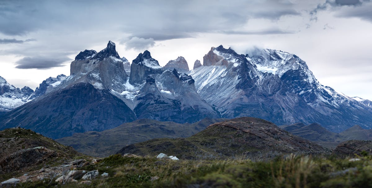
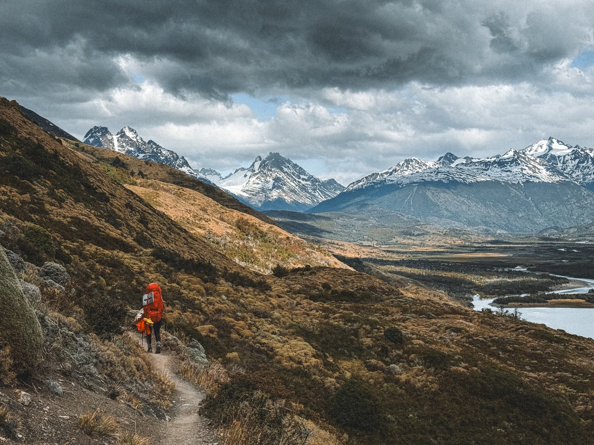
Days 2-5: Torres del Paine — The W Trek (or Day Hikes If You're Smarter Than Me)
I did the W Trek in four days. Most people take five, and those people are right. Four days was too fast. I was rushing to make a campsite booking that I could not move, and by day three my knees were filing a formal complaint.
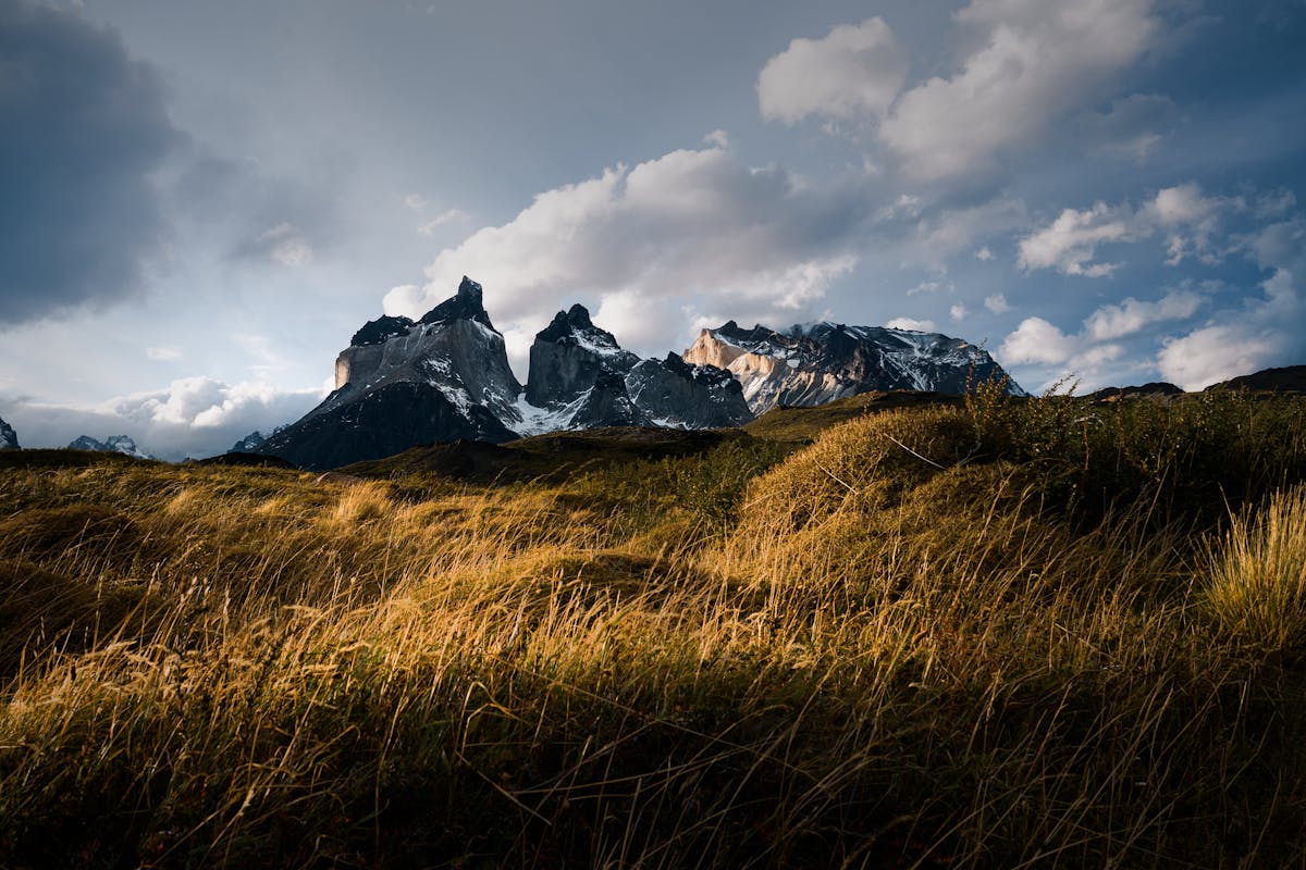
The W Trek covers roughly 80 kilometers through Torres del Paine National Park, hitting three major viewpoints: the Grey Glacier, the French Valley, and the base of the Torres towers. It is shaped like a W on the map (hence the name, no points for creativity). You can walk it east-to-west or west-to-east. I went west-to-east, starting at Paine Grande and finishing at the Torres base, because I wanted to save the towers for last.
The weather in Torres del Paine is its own character. I had sun, rain, sleet, and wind strong enough to push me sideways — all in a single afternoon. You do not check the forecast here. You layer up and accept whatever comes. A shell jacket and rain pants are not optional. They are mandatory.
Day 2: Paine Grande to Grey Glacier
The catamaran from Pudeto drops you at Paine Grande, and from there it is about 11 km along the lake shore to the Grey sector. The trail is flat and exposed. The wind was brutal — I was leaning at a 30-degree angle for the last two kilometers. But then you round a corner and Grey Glacier appears, filling the entire horizon, blue-white and enormous, with icebergs bobbing in the lake below it.
I stood there for twenty minutes. Partly because the view demanded it. Partly because the wind had battered me into a kind of stupor.
Day 3: French Valley
The French Valley is the hardest day on the W but also the most spectacular. The trail climbs steeply through lenga forest into a hanging valley surrounded by granite walls on three sides. If you are lucky, you will hear avalanches crashing off the glaciers above — a sound like distant thunder that echoes around the valley for thirty seconds.
I made it to the Britanico viewpoint at the top and the 360-degree panorama was worth every aching step. Granite spires, hanging glaciers, turquoise lakes below. My phone camera could not capture it. Nothing can. You just stand there and try to store it somewhere in your brain.
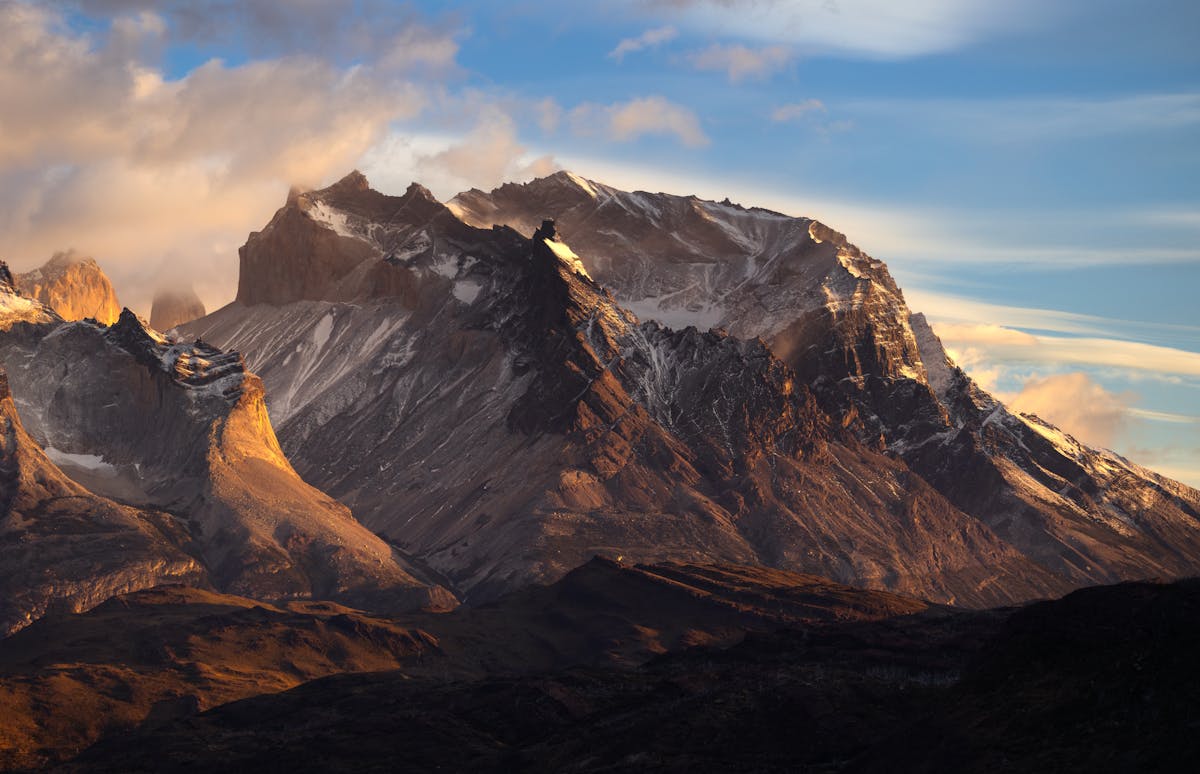
Day 4-5: The Torres Base
The final day is the reason most people come. A steep scramble up a boulder field in the dark (you need to leave by 4:30am to catch sunrise) brings you to the base of the three granite towers — the Torres themselves. The towers glow orange at sunrise for about fifteen minutes. If you get clouds, you get nothing. I got clouds for the first hour, then a gap opened and the light hit. Fifteen minutes of the most dramatic scenery I have seen anywhere. Then the clouds closed again.
For a deeper breakdown of the W Trek logistics, bookings, and day-by-day detail, read my complete W Trek guide.
Not Doing the W? Day Hikes Work Too
If you do not have four to five days for the full W, or you do not want to carry a pack, you can base yourself in Puerto Natales and do day trips into the park. The day hike to the Torres base is doable as a long day (leave at 5am, return by 7pm). You can also visit Grey Glacier on a day trip by catamaran. You will miss the French Valley and the overnight immersion, but you will still see the park's greatest hits.
Day 6: Puerto Natales Recovery Day
I came off the W Trek looking like someone had left me in a tumble dryer for four days. My boots were soaked. My body was sore in places I did not know had muscles. I spent this day doing laundry at a lavanderia (they do it by weight — about $5 USD per kilo), eating an enormous lunch, and sitting in a cafe reading a book for the first time in a week.
You need this day. Do not try to bus to Punta Arenas the same day you finish the trek. Your body has earned a rest, and Puerto Natales is pleasant enough to spend a day doing nothing.
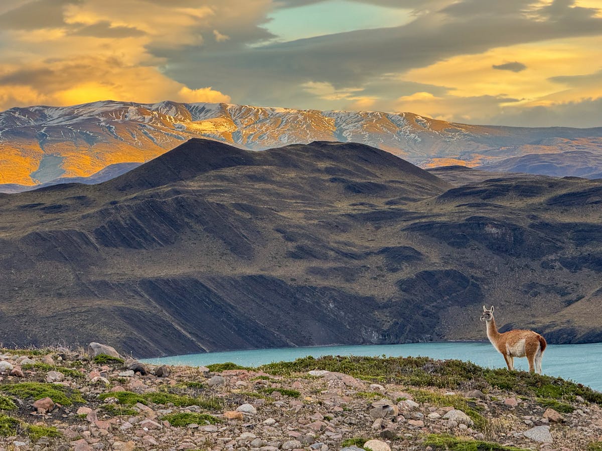
If you have energy, the Patagonia National Park (formerly the Estancia Valle Chacabuco) is accessible as a day trip and barely gets visitors compared to Torres del Paine. The grasslands there are full of guanacos and the silence is extraordinary.
Day 7: Punta Arenas — More Than a Transit Stop
Most people treat Punta Arenas as a place to change buses. I gave it a full day and was glad I did. It is a proper city — Chile's southernmost — perched on the Strait of Magellan with a cold, wind-scoured charm that grows on you.
The municipal cemetery is, oddly, the highlight. It is enormous, lined with cypress hedges, and full of ornate mausoleques from the wool-baron era when this city was one of the richest in South America. The central plaza has a statue of Magellan, and there is a local tradition of touching the toe of the indigenous figure at the base for good luck. The toe is worn to a shine.
If you are interested in Antarctic expeditions, Punta Arenas is where most of them depart from. I did not have the budget (or the time) for that this trip, but seeing the Antarctic cruise ships in the port planted a seed.
The bus from Puerto Natales to Punta Arenas takes about three hours. Buses Fernandez and Bus Sur run the route multiple times per day. I took an early morning departure and watched the steppe roll by — guanaco herds, estancia fences disappearing into the distance, and the occasional condor circling above the road. The landscape between these two towns is emptier than you expect. It drove home how sparse this part of the world really is.
In Punta Arenas itself, I wandered the waterfront in the late afternoon. The Strait of Magellan was flat and grey, and a container ship was sliding past on its way to the Pacific. Before the Panama Canal, every ship in the world came through here. You can feel that history in the architecture — the grand mansions along the plaza, the old port warehouses, the sense that this city used to matter more than it does now.
Day 8: The Tierra del Fuego Crossing — A Full Day of Moving
This is the day that separates the Chile-only itinerary from the combined trip. Getting from Punta Arenas to Ushuaia means crossing through Tierra del Fuego — the big island at the bottom of South America that Chile and Argentina split between them.
The route involves a bus from Punta Arenas to Porvenir (with a ferry crossing of the Strait of Magellan), then another bus across the island to the Argentine border at San Sebastian, then onward to Rio Grande and finally Ushuaia. It takes about 12-14 hours total and you will cross two international borders.
The ferry across the Strait is the highlight. About two hours on a flat, cold deck watching for dolphins while the wind tries to remove your hat. The Tierra del Fuego landscape itself is bleak in the most beautiful way — flat grassland stretching to the horizon, no trees, no people, just sheep and fences and an enormous sky.
Border Crossing Tips
Bring snacks and water — there are almost no services between Porvenir and Rio Grande. You cannot bring fresh fruit, meat, or dairy across the Argentine border (they check). Have your passport ready and carry printed copies of any onward travel bookings. The border agents occasionally ask to see proof of onward travel, and phone signal is nonexistent at the crossing.
An alternative to this overland route is flying from Punta Arenas to Ushuaia, but there are no direct flights. You would need to fly through Buenos Aires or Santiago, which takes longer and costs significantly more. The bus is slow but it is the right choice.
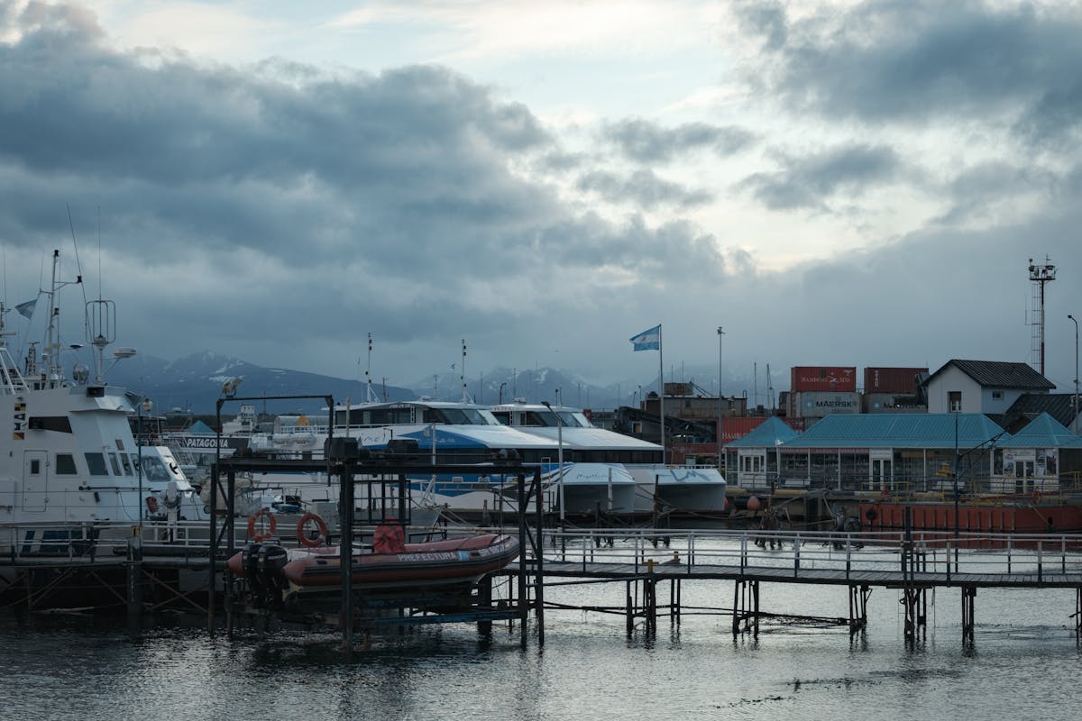
Days 9-10: Ushuaia — The End of the World, Apparently
Ushuaia calls itself "the southernmost city in the world" and puts that slogan on everything. It is also a functioning port town wedged between mountains and the Beagle Channel, with decent seafood restaurants, a handful of museums, and access to Tierra del Fuego National Park.
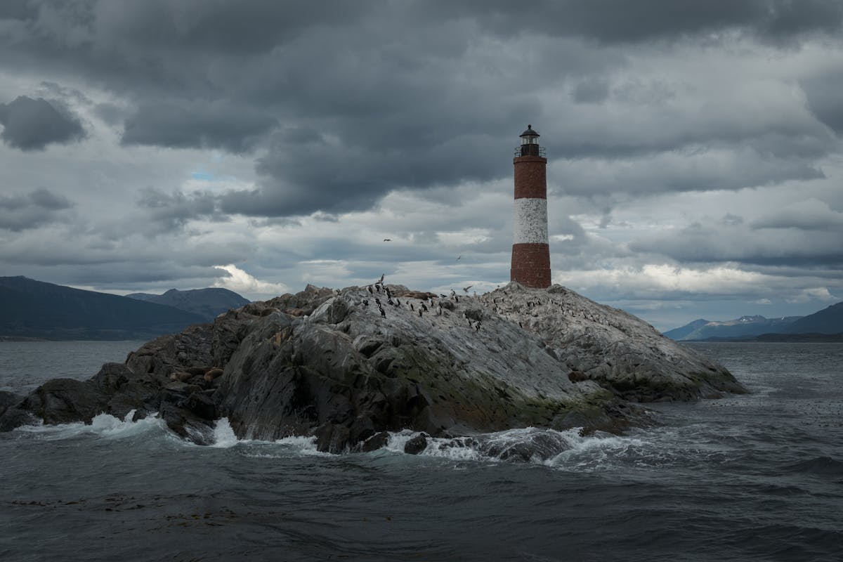
I arrived exhausted from the overland crossing and slept for eleven hours. The next morning I walked to the harbor and booked a Beagle Channel boat tour — about four hours on a catamaran past sea lion colonies, cormorant islands, and the photogenic Les Eclaireurs Lighthouse (which everyone calls "the lighthouse at the end of the world" even though it is not technically the one from the Jules Verne novel).
On day two I went to Tierra del Fuego National Park. The Tren del Fin del Mundo (End of the World Train) is a tourist trap — it is slow, expensive, and covers a tiny portion of the park. Skip it. Instead, take a taxi or bus to the park entrance and hike the Costera Trail along the Beagle Channel shore. It is flat, easy, and the forest-meets-ocean scenery is unlike anything else on this trip.
Ushuaia Eating
The centolla (king crab) in Ushuaia is just as good as Puerto Natales and slightly cheaper. I ate it at a place on the main drag — boiled, with lemon and mayonnaise, nothing fancy — and it was enormous. Budget about $25-30 USD for a centolla plate at a decent sit-down restaurant. The lamb here is also excellent — Patagonian lamb slow-roasted on a spit is something you should eat at least once on this trip.
Days 11-12: El Calafate and Perito Moreno — The Glacier That Moves
I flew from Ushuaia to El Calafate. There are daily flights and the route takes about an hour. You can also bus it, but it takes 18 hours through Rio Grande, and by this point in the trip I had done enough bus time to last a lifetime.
El Calafate is a tourist town built around one attraction: Perito Moreno Glacier. The town itself is fine. There is a main drag with chocolate shops, gear stores, and restaurants, all pitched at foreign hikers with debit cards. It feels more polished than anywhere on the Chilean side — Argentina invests heavily in its Patagonian tourism infrastructure.
But Perito Moreno. I was not prepared for Perito Moreno.
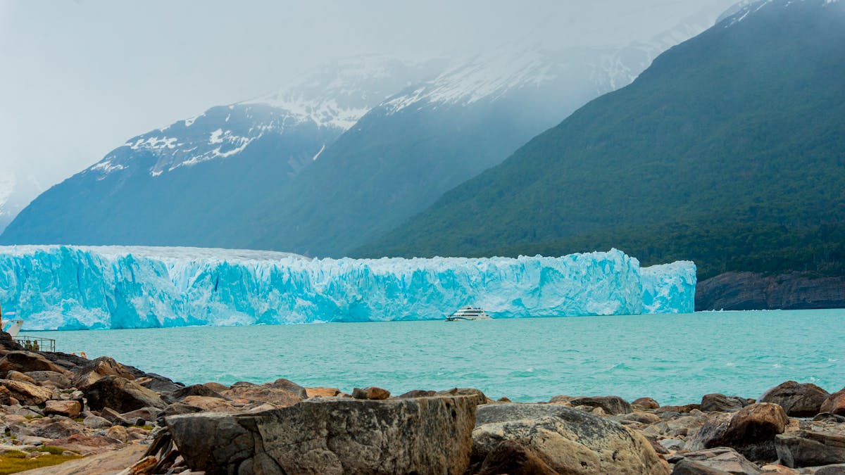
The glacier is about 80 km from town (an hour-and-a-half drive) in Los Glaciares National Park. You can visit independently by renting a car or taking a bus from the terminal, or join a tour. I took the regular bus — about $15 USD round trip — because the walkways at the glacier are self-guided and you do not need a guide to stand there with your mouth open.
The walkways are built into the hillside opposite the glacier face, and you can spend two to four hours moving between viewpoints at different heights and distances. Every few minutes you hear a crack, and if you are looking at the right spot, you see a piece of ice the size of a building peel off the face and crash into the water below. The sound reaches you a second later.
If you want to get onto the ice itself, book the "minitrekking" excursion in advance. You strap on crampons and walk on the glacier for about 90 minutes with a guide. I did not do this — it was fully booked by the time I tried — so book ahead if it matters to you. About $150-180 USD per person.
Quick Tip
Go to Perito Moreno in the afternoon. The morning tours arrive around 10am and the walkways are packed until about 1pm. Afternoon light is also better for photography — the sun hits the glacier face directly and the blue color intensifies. I arrived at 2pm and had sections of the walkway almost to myself.
Days 13-14: El Chalten and Fitz Roy — The Grand Finale
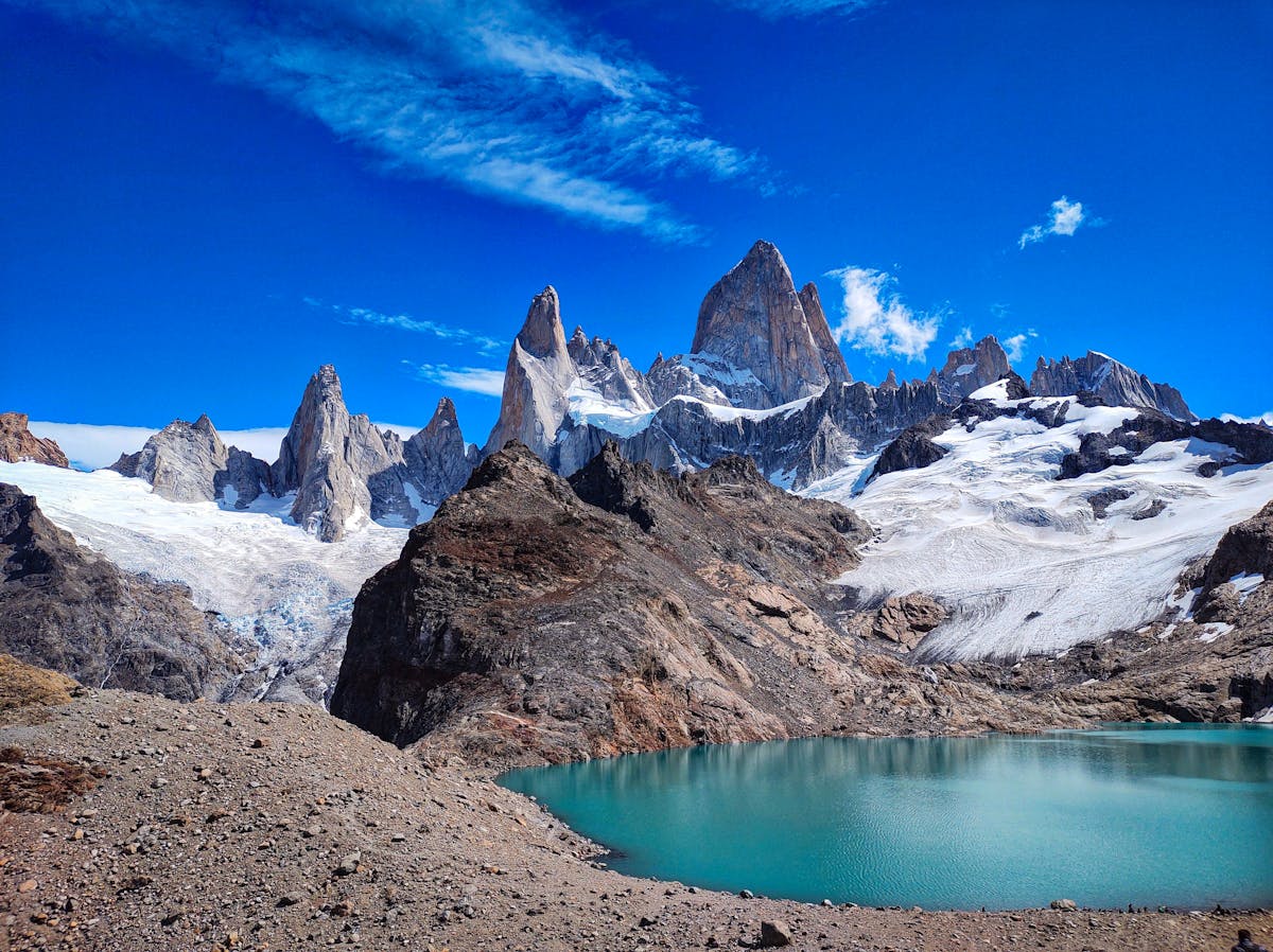
The bus from El Calafate to El Chalten takes about three hours through flat steppe, and then suddenly, about forty minutes before you arrive, Fitz Roy appears on the horizon. The entire bus went quiet. Phones came out. The driver, who has clearly done this a thousand times, slowed down without anyone asking.
El Chalten is tiny — a few blocks of hostels, restaurants, and gear shops at the base of the Fitz Roy massif. It was founded in 1985, primarily so Argentina could claim this stretch of the border, and it still has the feel of a frontier town that exists because the mountains behind it demanded it. It is also Argentina's self-proclaimed "trekking capital," and for once the marketing is not wrong.
Day 13: Laguna de los Tres (Fitz Roy Viewpoint)
This is the big one. The hike to Laguna de los Tres starts from the edge of town (no transport needed, just walk) and covers about 25 km round trip with 750 meters of elevation gain. The first eight kilometers are a gentle uphill through forest. Then the last kilometer before the laguna is a brutal, steep scramble up loose rock that takes about an hour.
And then you arrive at the top and Fitz Roy is right there, filling your entire field of vision, with a turquoise glacial laguna at its base. On a clear day, the granite spires are so sharp against the sky that they look fake. I sat up there for an hour eating almonds and staring.
The weather window matters enormously here. Fitz Roy is famous for being socked in with cloud — some people wait in El Chalten for three or four days and never see it clear. I got lucky on my one shot. Check the forecast the night before and be flexible. If it is clear at 6am, go. Everything else can wait.
Day 14: Laguna Torre or Rest Day
If your legs still work, the Laguna Torre trail is the second-best hike in El Chalten. It is shorter than the Fitz Roy hike (about 18 km round trip), flatter, and ends at a laguna with a view of Cerro Torre — a needle-thin granite spire that is considered one of the hardest climbs in the world. The trail follows the Rio Fitz Roy through forest and steppe, and the wind was calmer on this side when I went.
If your legs do not work (mine barely did), spend the day eating in town. The microbreweries in El Chalten are surprisingly good. I had a stout at a place near the main road that was as good as anything I have had at home. Pair it with a pizza and stare at the mountains through the window. You have earned it.
One thing about El Chalten that separates it from every other stop on this trip: the trailheads are free. No permits. No bookings. No entry fees. You just walk from your hostel to the edge of town and start hiking. After the bureaucratic gauntlet of Torres del Paine — booking campsites months in advance, paying park entry, coordinating catamarans — El Chalten felt like freedom. The Argentines got this right.
The town itself shuts down early. By 10pm the restaurants are closing and the streets are empty. I sat outside my hostel on the last night watching the clouds clear off Fitz Roy as the sun went down, and the pink alpenglow lasted for almost forty minutes. Nobody photographed it because everyone had already gone to bed. That felt like a secret — the kind of moment you get for staying somewhere long enough.
The Practical Stuff — Budget, Transport, and Timing
When to Go
The Patagonia season runs from October to April. January and February are peak — the warmest, the busiest, and the most expensive. I went in late November and found it ideal: long daylight hours (18+ hours), campsites not yet at capacity, and prices about 20% lower than January. The catch is more rain and colder nights. Check our when to visit guide for month-by-month detail.
March is underrated. The crowds thin out, the autumn colors in El Chalten are spectacular, and the weather is more stable than early season. Temperatures drop but the days are still long enough for big hikes.
Budget Breakdown
| Category | Budget Estimate (14 days) |
|---|---|
| Flights (Santiago-Puerto Natales, Ushuaia-El Calafate) | $250-400 USD |
| Accommodation (hostels/dorms) | $280-420 USD ($20-30/night) |
| W Trek campsites (4-5 nights) | $40-60 USD |
| Food (mix of cooking and eating out) | $350-500 USD |
| Buses (Puerto Natales-Punta Arenas-Ushuaia-El Calafate-El Chalten) | $120-180 USD |
| Park entries (Torres del Paine + Los Glaciares + TDF NP) | $60-80 USD |
| Tours (Beagle Channel, Perito Moreno bus) | $50-80 USD |
| Total (budget traveler) | $1,150-1,720 USD |
This assumes camping on the W Trek, hostels elsewhere, cooking some meals, and not doing the glacier minitrekking. If you stay in refugios on the W and eat out every meal, add $500-800 on top. For more detail on costs and how to save, see our money and costs guide.
Getting Around
Buses are the backbone of Patagonian transport. They are comfortable (most are semi-cama with reclining seats), roughly on time, and cheap by international standards. The main operators on the Chilean side are Buses Fernandez, Bus Sur, and Buses Pacheco. On the Argentine side, Chalten Travel and TAQSA/Marga cover most routes.
Book bus tickets in person the day before or online through the operator's website. During peak season (January), the popular routes sell out — especially Puerto Natales to Torres del Paine and El Calafate to El Chalten. Do not assume you can walk up and buy a ticket same-day.
For a full overview of all transport options, read our getting around Chile guide.
Border Crossings — What to Expect
You will cross the Chile-Argentina border at least twice on this itinerary (at Tierra del Fuego and potentially again if you re-enter Chile from El Calafate). The crossings are straightforward but slow. Expect 30-60 minutes at each checkpoint while every passenger gets off the bus, shows their passport, goes through customs, and gets back on.
What they check for: fresh food (Argentina is strict about fruit, meat, and dairy), camping gas canisters (sometimes confiscated), and large amounts of cash. What they do not check for: your life story. Keep your passport accessible, be polite, and it is painless.
US, EU, UK, Canadian, Australian, and New Zealand citizens do not need a visa for either Chile or Argentina for stays under 90 days. You get a stamp at each border — keep track of your days if you are on a longer South America trip.
What I Would Change Next Time
Five things:
1. More time in El Chalten. Two days was not enough. I would add a third day for the Laguna Torre hike and a possible attempt at the Huemul Circuit if conditions are right. El Chalten is the place on this route where I felt most relaxed, and rushing out felt wrong.
2. Skip the Tren del Fin del Mundo in Ushuaia. I did not ride it, but I walked past the station and talked to people who did. Universal verdict: overpriced and underwhelming. Use that time on the Costera Trail instead.
3. Book the Perito Moreno minitrekking a month in advance. I tried to book three days before and it was full. If walking on a glacier matters to you — and it should — book early.
4. Bring better wind protection. My rain shell was fine for rain but the wind in Torres del Paine found every gap. A proper windproof hardshell with a hood that cinches tight is non-negotiable. My fleece-under-rain-jacket setup was not enough on the exposed ridges.
5. Carry more cash. The ATM situation in Patagonia is genuinely bad. Machines run dry, cards get rejected, and some hostels are cash-only. I would start the trip with at least $300 USD worth of Chilean pesos and $200 USD worth of Argentine pesos. Exchange rates at casas de cambio in Punta Arenas and El Calafate are reasonable.
Is Two Weeks Enough?
Barely. Two weeks covers the greatest hits but leaves no room for weather delays or the spontaneous "I want to stay another day" decisions that make a trip memorable. If I had three weeks, I would add a day in El Chalten, a day at puma tracking near Torres del Paine, and possibly the Carretera Austral segment north of Puerto Natales.
But two weeks is enough to see Perito Moreno calve, to stand at the base of the Torres at sunrise, to eat king crab in two countries, and to cross Tierra del Fuego in a rattling bus while the wind shakes the windows. It is enough to understand why people come back to Patagonia. I will be one of them.
For a broader Chile trip that includes Patagonia plus the north, see my two-week Chile itinerary.